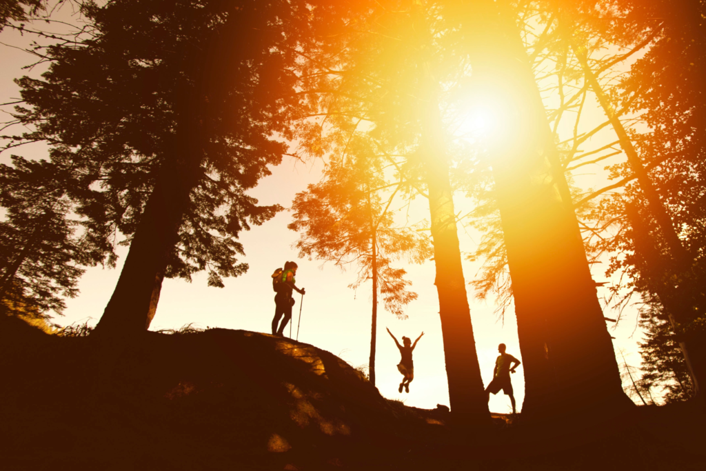
SFGATE staffers, like other Bay Area residents, spent a whole bunch of 2020 hiking anywhere and everywhere, for sights and sounds and exercise and all the rest. And that’s good news for you, reader with zero hiking experience — or reader who’s looking for a new, hidden trail — because now we have lots of recommendations.
Below, our nine favorites from recent expeditions, many of which link out to a larger feature story, so you can assess for yourself which locales might be right for you (or just learn more about a trail’s history). They’re listed alphabetically; we refuse to rank them, because they’re each perfect in their own way.
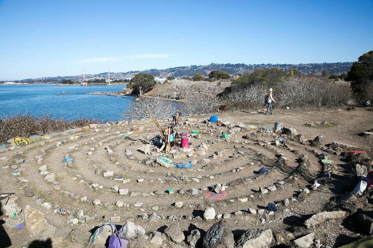
Albany Bulb
Location: 1 Buchanan St. in Albany
“Offering both sweeping views of the San Francisco skyline and human-made sculptures crafted from found materials, these days, the Bulb evokes more of a sense of whimsy than it does the desolation of a landfill. Wet dogs pitter-patter gleefully down dirt trails, and children exclaim with wonder as they discover life-size dinosaurs made of driftwood and rebar.
“Despite the city of Albany’s vow to preserve the art of its treasured trash island, it’s hard to imagine the Bulb looking quite the same after a park-creating facelift. Enjoy it while you can, with all its jagged bits and bobs — surely, the most weirdly beautiful a former landfill has ever looked.”
Read more about the history of the Albany Bulb from SFGATE reporter Madeline Wells.
Black Diamond Mines Regional Preserve
Location: 5175 Somersville Road, near Antioch
“A great spot to find a hike for all ability levels and interests, Black Diamond Mines is a hidden gem in Contra Costa County,” says SFGATE managing editor Katie Dowd. “Once the home of five coal mining towns — now all abandoned — it’s a history lover’s dream. The highlight is a pioneer cemetery on the hill, but if you’re not interested in a steep climb, there are plenty of flat and even paved routes through the park for a casual stroll.”
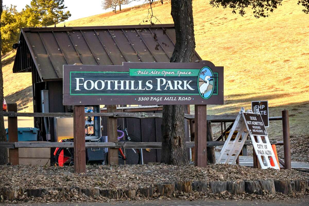
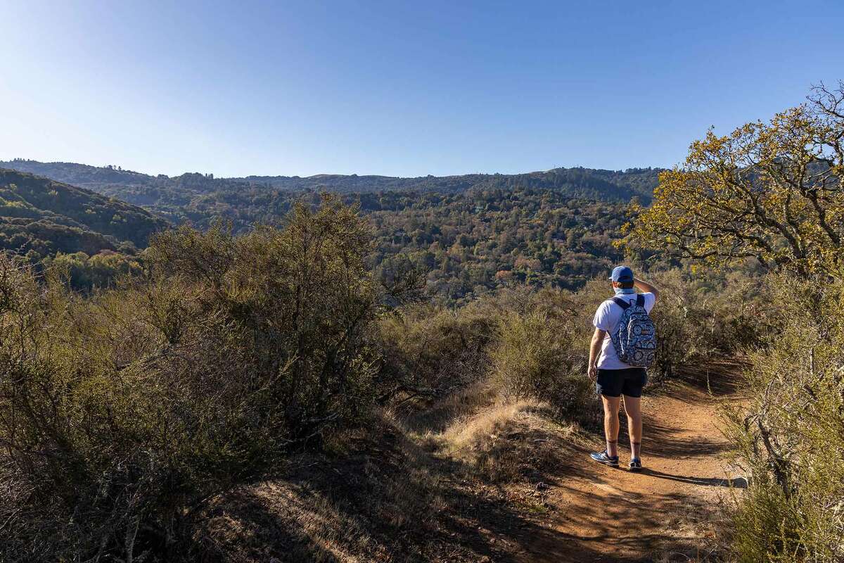
Foothills Park
Location: Santa Cruz Mountains in Palo Alto
After decades of being shut down to non-Palo Alto residents, Foothills Park is finally open to everyone. SFGATE editorial director Grant Marek hiked the whole thing and calls it “majestic,” adding, “The hike is hard, but not too hard, with just under 1,000 feet of elevation — I could hike that every day of my life and be 100% satisfied.”
Read his review here.
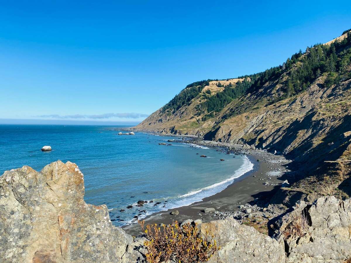
Lost Coast Trail
Location: King Range National Conservation Area
This 24.6-mile journey isn’t for casual campers, writes SFGATE’s California parks editor Ashley Harrell. “On the Lost Coast, bears and rattlesnakes are common. Storms and fog can move in without warning. The ocean is sometimes violent, with ‘sneaker waves’ claiming more than a few unlucky backpackers. Intimidatingly, the trail weaves in and out of the tidal zone, where wrong timing can leave hikers trapped between sheer cliffs and an encroaching sea.” Still interested? Read about Harrell’s trek.
Montara Mountain Trail
Location: San Pedro Valley County Park, near Pacifica
“One of the best returns on uphill-hiking investment in the Bay Area has to be the Montara Mountain Trail,” says SFGATE homepage editor Greg Keraghosian. “The reward for completing this 6.7-mile loop is a stunning panoramic view that includes Montara State Beach to the west, the Golden Gate Bridge to the north and the Port of Oakland to the east. There’s an odd bonus at the peak should you wander off the fire trail: abandoned, rusted cars that seem to have been enjoying their ocean views for decades.”
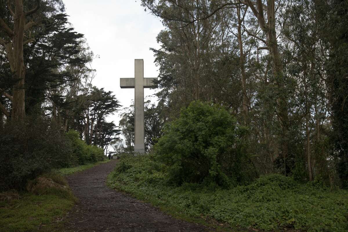
Mount Davidson
Location: San Francisco
Have you visited the Mount Davidson Cross? “Starting from the Miraloma Park neighborhood, if you trek halfway up the steep path on the eastern side of Mount Davidson you’ll catch a glimpse between the trees of a concrete crucifix,” writes SFGATE local editor Andrew Chamings. “Only when you get to the top can its magnitude be fully realized. The giant concrete cross is in its fifth iteration, with all previous wooden versions burned into the soil through protest and arson.”
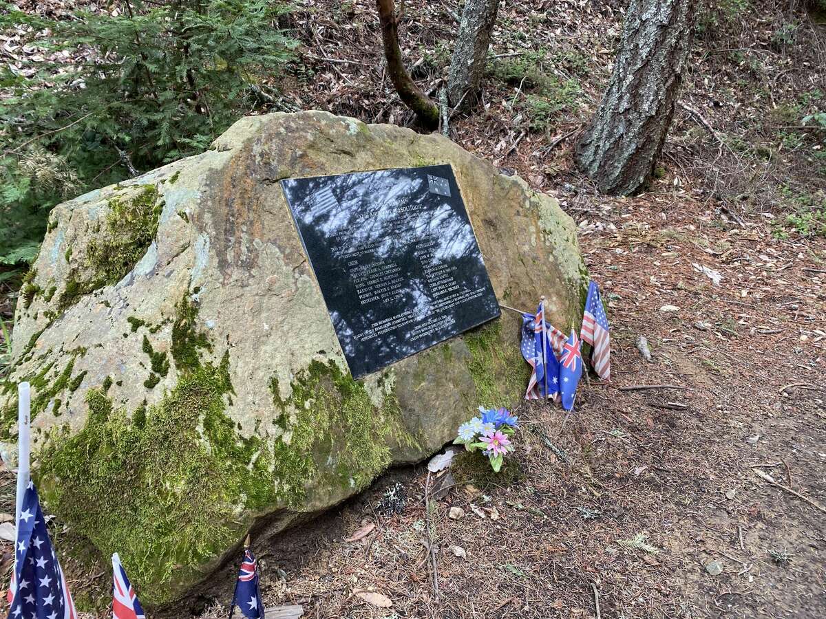
Resolution Trail
Location: El Corte de Madera Creek Preserve
Resolution Trail is “part of a commemorative loop that winds through the Kings Mountain canyon and past the crash site of an ill-fated DC-6 commercial airplane bearing the same name,” writes Marek. “… The aura of a 67-year-old plane crash is gripping enough that it’s very clearly more than just a ‘thing,’ which is maybe why I can’t stop going back.”
Read about Marek’s full experience here, including his step-by-step directions to arrive at your destination.
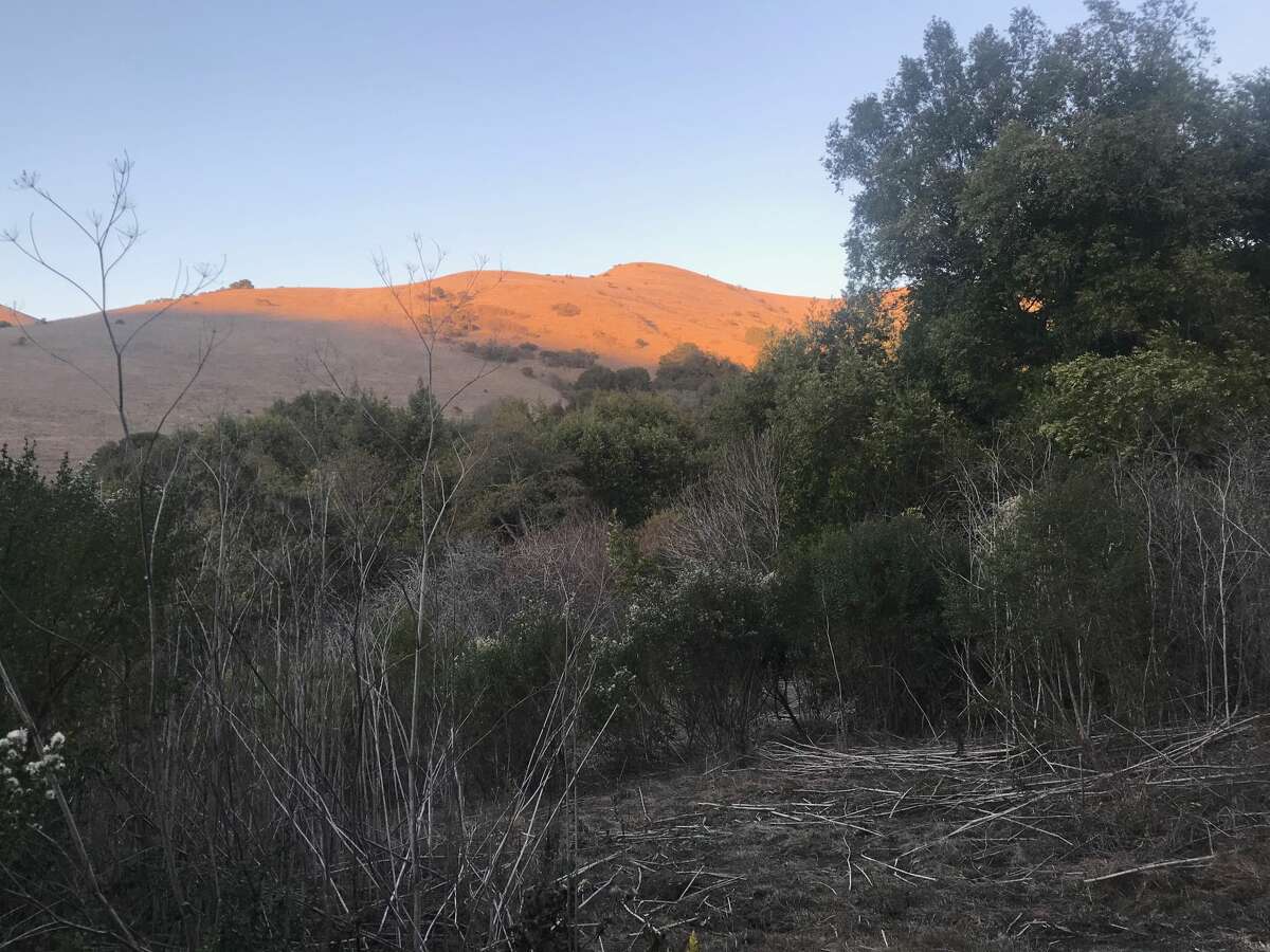
Rifle Range Road Trail
Location: Wildcat Canyon, right off Arlington Boulevard on the El Cerrito-Richmond border
If you can put up with a hill steep enough to make you regret forgetting your inhaler again, SFGATE hompage editor David Curran says you’ll be rewarded with some delightful views. “Just focus on the grassy hills of Wildcat Canyon out in the distance,” he writes. “Or enjoy the trail lined with oaks and laurels, and, in the understory, the bare buckeye, the toyon with their red berries and bracken mixed in with other vegetation. And the wildlife can surprise you as well.” Best of all: The trail usually isn’t crowded. Here’s Curran’s breakdown.

Sweeney Ridge Trail
Location: Between San Bruno and Pacifica, about a 25-minute drive south from San Francisco
“Sweeney Ridge is an absurdly beautiful Bay Area hike — one side slopes down to the bay, the other to the Pacific Ocean from a 1,200-foot-high summit that offers views of the Farallon Islands, Mount Tam, Point Reyes, Mount Diablo, the Montara Mountains and San Pedro Point on a clear day,” writes Marek. “But what makes it particularly special is how steeped in history it is.” Want to learn more? Click here.